“Where every step tells a story”
September 13th - 15th







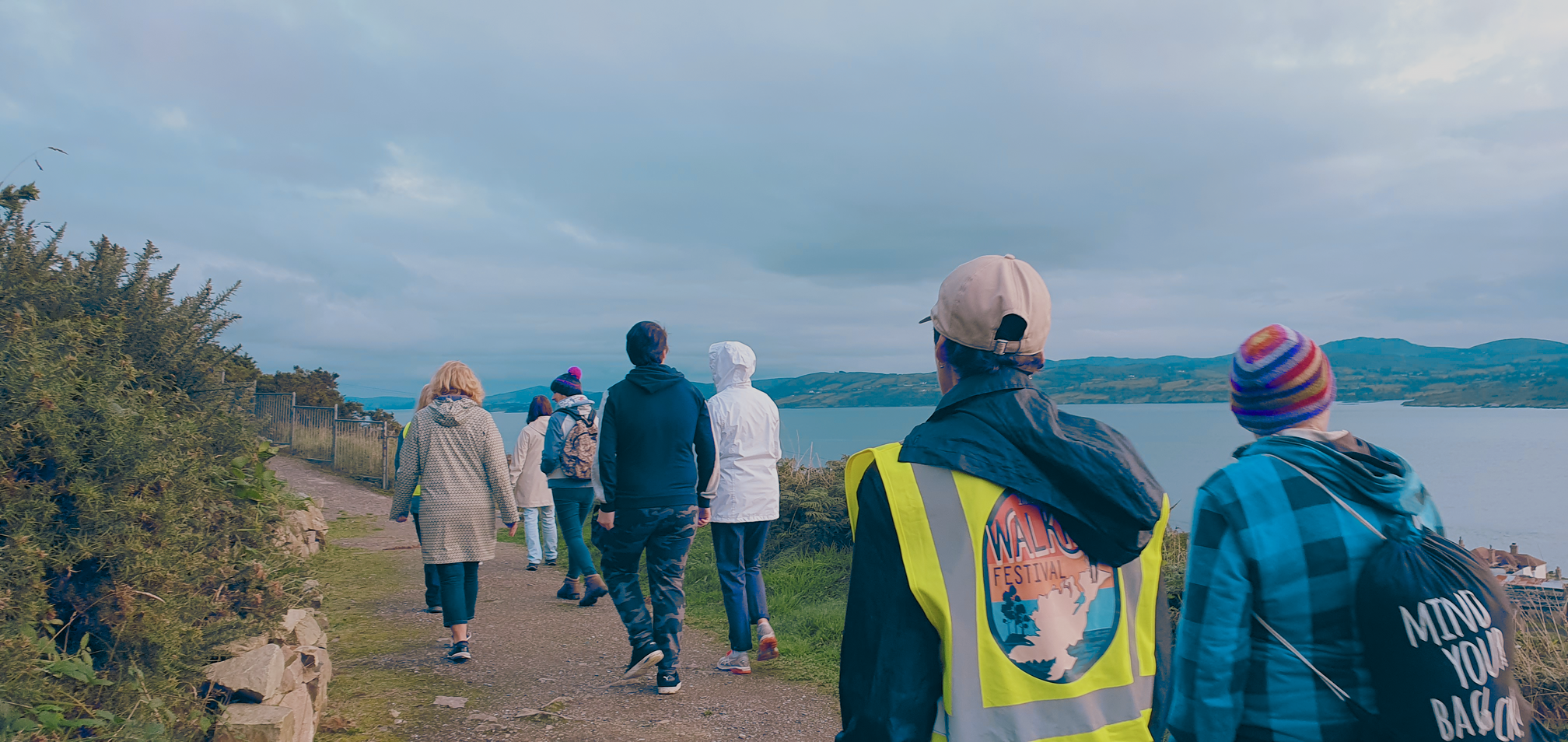
From September 13th to 15th, join us for an unforgettable weekend of adventure, nature, and community at the 2024 Inishowen Walking Festival. Discover hidden gems along scenic trails, enjoy family-friendly walks, and capture stunning photo opportunities.
Connect with fellow nature enthusiasts and participate in special events and workshops. Don’t miss out on this incredible opportunity to immerse yourself in the natural splendor of Inishowen!
Malin Head
Clonmany
Dunree Head
Drumfries
Buncrana
Glengad
Carndonagh
Moville
Shroove
Muff
Download the app
Newtowncunningham
See Below list of walks taking place across the peninsula this year with more to be added across the week.
BOOK YOUR PLACE NOW!
#InishowenWalkingFestival2024
Buncrana

Walk 1: Heritage Walk
When?: Saturday September 14th, 12 noon
Where?: Meet At The Stone Jug, Cahir O'Doherty Ave, Buncrana
Distance?: Approx 2 -3 km. Easy, flat,( mostly pathways).
Duration?: Approx. 90 mins.
Dog friendly?: Well Behaved Dogs welcome on a leash
What to bring?: Rain Jacket, sunscreen, water
Accessibility: Wheelchair and Buggy friendly
Enjoy a walk in the historic and scenic Cahir O Doherty Avenue, Castle Bridge, Swan Park area of Buncrana. Enjoy a potted history of the area from early settlement to medieval. Hear snippets of history from the building of the modern the of Buncrana in 1718 to Wolfe Tones landing at Buncrana in 1798 and the history of the spinning mills in what is now Swan park and it’s benefactor Harry Swan.
Buncrana

Walk 2: Wellness wander
When?: Friday September 13th , start 6pm
Where?: Meet At The Exchange, Castle Avenue, Buncrana, F93 FE09
Distance?: Approx 2 - 3km , Easy , Flat / smooth (mostly pathways)
Duration?: Approx 1 hour
Dog friendly?: Well Behaved Dogs welcome on a leash
What to bring?: Rain Jacket, sunscreen, water
Accessibility: Wheelchair and Buggy friendly
Take a gentle evening stroll with us to unwind and de-stress. Slow down, relax and enjoy nature for this lovely well-being walk with opportunities to enjoy mindfulness, poetry and music along the way. Discover the benefits of walking for mental health. Hosted by Insight Inishowen, this walk will start from The Exchange Community Centre at 6pm and end up back at the centre after one hour for refreshments. Watch out for some heart-warming surprises along the way.
Buncrana

Walk 3: An Amazing Journey
When?: Sunday September 15th , start 3pm
Where?: Amazing Grace Park, Tourist Office, Railway Road, Buncrana
Distance?: Approx 2 - 3km , Easy , Flat / smooth (mostly pathways)
Duration?: Approx 1 hour
Dog friendly?: Well Behaved Dogs welcome on a leash
What to Bring?: Rain Jacket
Accessibility: Wheelchair and Buggy friendly
From pop concerts to civil rights marches and from folk music to funerals, the song Amazing Grace is known and loved around the world. Join us for a walk through Amazing Grace Country discovering the story behind the song and its connection with Inishowen. Starting at the Amazing Grace Park at 3pm on Sunday afternoon, we will walk along the shore to the Amazing Grace Viewing Point before ending up at The Exchange Community Centre for a delicious afternoon tea (transfers back to the car park available on request). Watch out for a little music and a few surprises along the way.
Fully booked !
Dunree

Walk 1: Fox’s Rock & Bulba Way
When?: Saturday September 14th, start 10AM
Where?: Meet At Artlink, Fort Dunree , F93C424
Distance?: 8.5km , Moderately Strenuous, Bog tracks and hill
ground which may be boggy and wet in places.
Duration?: Approx 3-4 hrs
Dog friendly?: No Dogs Please
What to bring? : Rain Jacket, Walking Shoes, Camera, Water
Accessibility: Paths and trails not suitable for wheelchairs and pushchairs
This hike is a looped walk which will travel towards and just under the iconic Bulbin Mountain. Guided by Sharon Porter of Solas Ireland Walks and Hikes, this is a tranquil and gorgeous walk with stunning views of the Urris Hills, Desertegney, Clonmany and Lough Swilly throughout. This hike is over mixed terrain including track, bog and hill ground which may be boggy, slippery and rocky underfoot. A good level of fitness is required for this walk with up-hill sections and a total ascent of 250 metres.
Dunree

Walk 2: The Whispering Sea
When?: Sunday September 15th, start 2:30pm
Where?: Meet At Artlink, Fort Dunree , F93C424
Distance?: 3km , Easy , tracks and trails
Duration?: Approx 2hrs
Dog friendly?: Well behaved dogs on leads only please
What to bring? : Rain Jacket, Walking Shoes, Camera, Water
Accessibility: wheelchairs and buggies could struggle on the trails
The International Artist in Residence at Artlink at the time of the Inishowen Walking Festival is Arijit Bhattacharyya. Born in West Bengal, Arijit is an artist and independent curator currently based in Weimar. He will spend one month in the area gathering materials for an exhibition at Fort Dunree. He will use the gallery space as his studio. For the 'Walking Festival' he invites you for a stroll by the sea for a collective storytelling session.

Drumfries
Barna Mór and Barna Beag
When?: Friday September 13th, start 10am
Where?: Sliabh Sneacht Centre, Drumfries, F93 K6PH
Distance?: 6km , Moderately Strenuous, Loose blue stone path
Duration?: Approx 2 hrs
Dog friendly?: No Dogs Please
What to bring? : Walking Pole if desired as the path is fairly steep in parts, water,
Rainjacket, Camera.
Accessibility: Not suitable for wheelchairs and pushchairs
Starting from the Sliabh Sneacht Centre, this 6 km walk ascends the twin hills of Barna Mór and Barna Beag, known as the King and Queen of the Mintiaghs. The first half is uphill on a loose blue stone path, offering spectacular views of Lough Swilly, Sliabh Sneacht, Lough Min, Lough Fada, and the distant Atlantic Ocean. Led by a knowledgeable local guide, you'll explore unique upland flora and fauna in this unspoilt natural area, with stops to learn about the region's culture and heritage.
Malin Head

Walk 1: To Portmore Pier
When?: Friday September 13th, start 5:30pm
Where?: Malin Head Community Centre
Distance?: 5.4km , Easy, road and beach
Duration?: Approx 1hrs
Dog friendly?: Well behaved dogs on leads only please
What to bring? : Rain Jacket, Walking Shoes, Water and a smile!
Accessibility: wheelchairs and buggies could struggle on the beach
This walk leaves Malin Head Community Centre and goes right to an area known as the Captains Road. This walk continues to Sandport and along the beach to the Port Mor Pier. There will be an informal chat of the local stories of Stumpy, Smuggling and the weather station formally the Coastguard Station. We will then return to the Community Centre, it takes about an hour and is suitable for all abilities
Malin Head

Walk 2: To Banbas Crown
When?: Saturday September 14th, start 10am
Where?: Malin Head Community Centre
Distance?: 10.5km , Strenuous
Duration?: Approx 2hrs
Dog friendly?: Well behaved dogs on leads only please
What to bring? : Rain Jacket, Suncream, Walking Shoes, Water and snacks.
Accessibility: Physically demanding walk, hills, may be difficult for wheelchairs and
buggys
Starting from the Community Centre on Saturday Morning 10am, We will embark upon Ballyhillion Tower (or Banba’s Crown). This walk returns the same way and has stunning views of the Garvin Isles, Instrahull and the Tor's.
Greencastle

Shroove Head Loop
When?: Saturday September 14th, start 11am
Where?: Shroove Head Carpark (NOT the beach carpark)
Distance?: 8km , Moderately Strenuous , Hilly Rough Terrain
Duration?: Approx 2-3 hours
Dog friendly?: Well behaved dogs on leads only please
What to bring? : Rain gear, Walking Shoes, Water and sunscreen
Accessibility: Strenuous hill walk/hike with loose stones underneath, not suitable for wheelchairs and buggies
Shroove Head Loop follows bog roads, laneways, rough tracks and minor roads and takes in a WWII Lookout Tower on Inishowen Head, the shoulder of Crocknasnug and the point at Portkill from where St Columba left for Iona. There is wonderful coastal scenery including, on clear days, Scotland. Guided by local historian George Gillespie.
Newtowncunningham
Newtowncunningham Loop
When?: Saturday September 14th, start 2pm
Where?: Newtowncunningham Orange hall , F93 RD79
Distance?: 10km , Moderately Strenuous , Mainly Roads, some paths
Duration?: Approx 2.3-3 hours
Dog friendly?: Well behaved dogs on leads only please
What to bring? : Rain gear, Walking Shoes, Water and sunscreen
Accessibility: Mainly surfaced road some pathway which may be slippy if wet, steep hills may be difficult for weelchairs and buggys
Walking a loop starting from Newtowncunningham Orange hall (F93 RD79) taking in the following attractions Site of the Castle, Newtowncunningham bridge, old Railway Station, Embankments, Grange graveyard, Blanket Nook wildlife sanctuary, Burt Castle, local churches

Muff
Greenway Wander to Wellness
When?: Sunday September 15th, start 10am
Where?: Kilderry/Muff Village,F93E032
Distance?: 2.5km , easy , flat, wheelchair accessable
Duration?: 1.5 hours
Dog friendly?: Well behaved dogs on leads only please
What to bring? : Rain gear, Walking Shoes, Water and sunscreen
Accessibility: Roads/pathways, wheelchair and buggy accessable
A short, walk & talk, on Muff Greenway, as it winds through Kilderry Woodland, delivered through English with bi-lingual references.
Facilitated by Michaela Mc Daid-Ecotherapy, the conversation will introduce and explore the benefits of social activity, bio-diversity and interests and the contribution these can make to wellness.
The emphasis is on talk, with the broad themes of environment, traditional cures and practices, local placenames and plant life and their origins in the Irish language.
Start point Muff Community Park but the event is designed to be entirely inclusive and can be accessed or joined at any point en-route.
Suitable for those with restricted mobility, using their normal support structures.
Moville
Vistas & Villas
When?: Sunday September 15th, start 2:15pm
Where?: St Eugene’s Hall via link minibus to Lafferty’s Lane
Distance?: 2.5km
Duration?: 2 hrs
Dog friendly?: No Dogs Please
What to bring? : Rain gear, Walking Shoes, Water and sunscreen
Accessibility: Minibus not accessible for wheelchair users
Taking in Moville’s historic seaside villas and the panoramic vistas their architects responded to - and how they framed key vistas and views - whether they were designing individual buildings or designing Moville’s beautiful public spaces.
Discover all kinds of 18th, 19th and 20th century architectural jewels and gems along Moville's shore path that, collectively contribute to making this picturesque, planned town a stand out place among the litany of Ireland's coastal towns.
Open to all ages and backgrounds we'll wend our way from Glenburnie at the bottom of Lafferty’s Lane via the Moville shore path, then meander up to Moville's historic core.